Resource Rend: Provinces of Old Japan
May. 16th, 2006 01:22 pmHere's a map of old Japan with their names. (A lot of the prefectures were renamed)
Anwyay:
http://www.samurai-archives.com/map.html
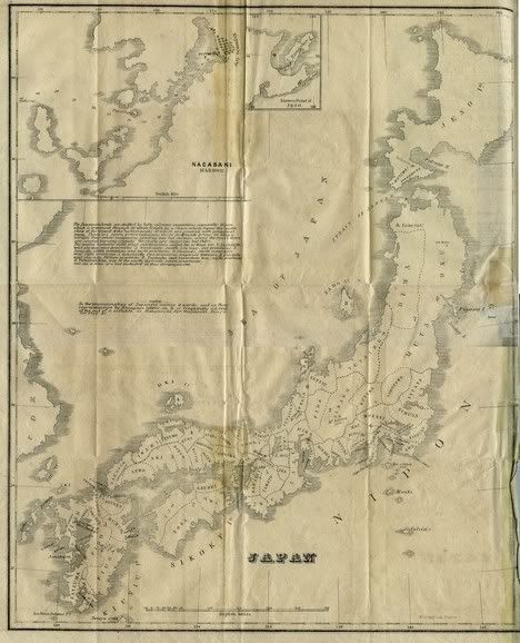
Here is a better map from the PCL Map Collection:

Found here: http://www.lib.utexas.edu/maps/historical/japan_1855.jpg
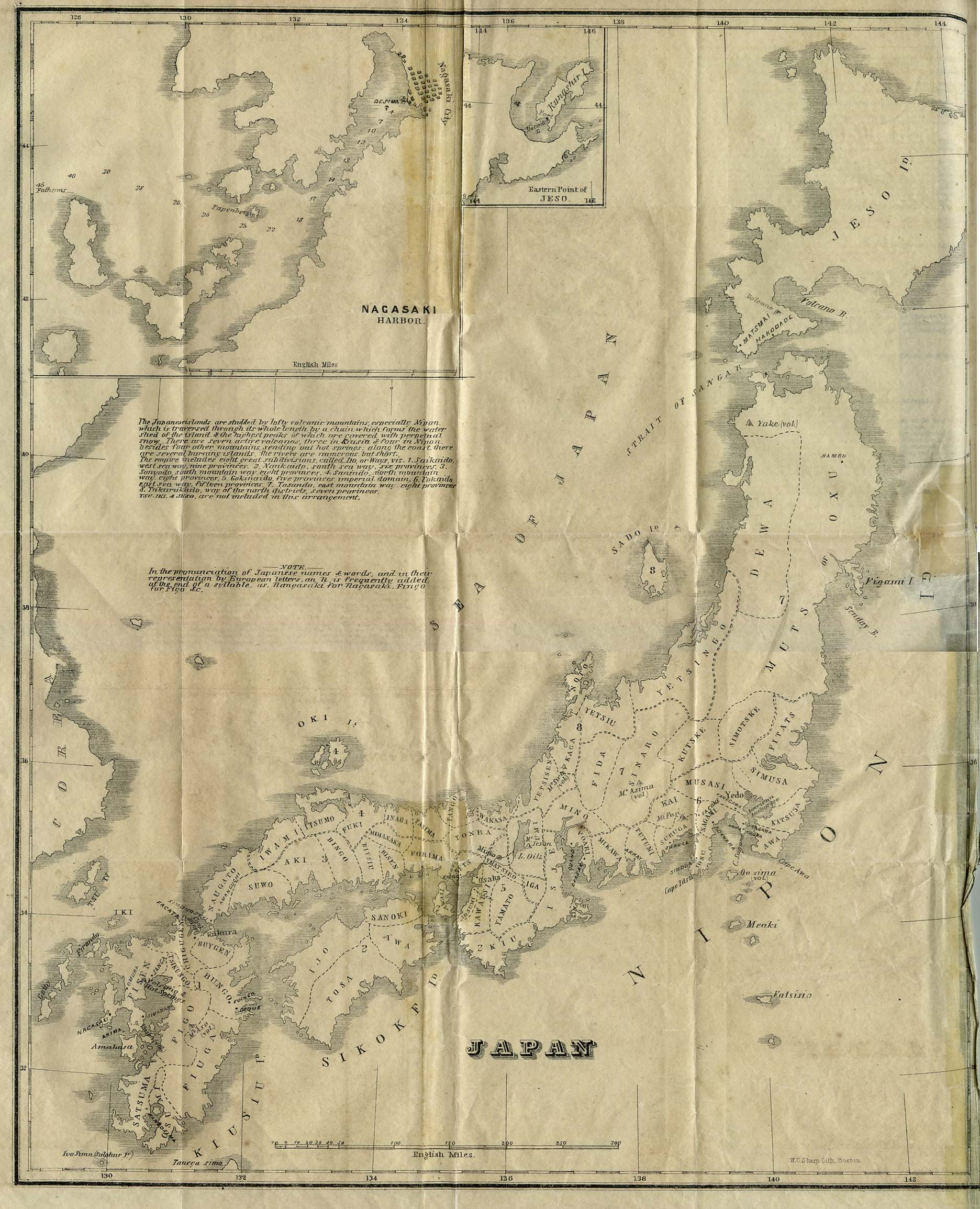
**From Japan as it was and is by Richard Hildreth. Phillips, Sampson, and Company 1855.
It's a more detailed map than the one in "The Samurai Archives" because other than Province Boundaries (Sagami, Sanuki) it has the Administrative Divisions(more modern) although around 1855 and presumably earlier it was called 'Do' roughly translated into 'Ways'.
Names in parenthesis are the ones in the "samurai archive" and the ones used in the fic. Names in the old map were written by a foreigner so it has letters like j etc. A Japanese friend assures me that there are few changes in Japan when it was closed so history books even if it's 200 years apart are ok for information. But really, LAND BOUNDARIES change so much in the feudal eras. I'm in 1600's and the earlies boundary map I have is 1855. It's really sad.
The Administrative Division, from the 1855 map, has grouped these provinces together:
Tokaido, East Sea Way: fifteen provinces. Fitats, Simusa, Katsusa, Awa, Musasi (Musashi), Sagami, Isu (Izu), Suruga, Kai, Tutumi and some other provinces I can't find.
So in the fic, the entire administrative division's head would be Happosai ruling the Tokaido. Ranma has Sagami. And Happosai stays at Musashi.
Ranma's han (fief) is in [12 Samurai Archives Map] (The Province of Sagami) which has a city called Kamakura where Rose Brier is. I relocated Nerima to Kamakura (yes, it's time for suspension of disbelief) to Kamakura so that there would only be one place for all of Ranma's cities.
Kuno land would be the Tosando, east mountain way: Dewa, Muts (Mutsu) Simotske, Kutske, Sinaro, Fida, Mino and Umi. Which by the way, is a large friggin amount of land. (7 in the PCL map)
Tendo land (2 on the PCL map) is Narikaido, South Sea way : Isje (Ise) and Kiu (Kii), Awa, Sanoki (Sanuki), Tosa, Ijo (Iyo), Awasi(Awaji) and Iga.
Although I'm placing both Ise and Kii in 5 (PCL MAP) so that Tendo land is surrounded by water.
I'm placing Ise and Kii as Ikaasei land along with Setsu (Settsu), Yamatsiro (Yamashiro), Yamato, Kawatsi (Kwatchi) and Izumi. This is Ikkaasei land. This is 5 on the PCL map bringing me an ordinate amount of trouble because this is Gokiraido or the Imperial Way.
Anyway... ... ... Here's the photoshop version of Rend with Ranma 1/2 characters as main political leaders. [click]
Anwyay:
http://www.samurai-archives.com/map.html
Here is a better map from the PCL Map Collection:
Found here: http://www.lib.utexas.edu/maps/historical/japan_1855.jpg
**From Japan as it was and is by Richard Hildreth. Phillips, Sampson, and Company 1855.
It's a more detailed map than the one in "The Samurai Archives" because other than Province Boundaries (Sagami, Sanuki) it has the Administrative Divisions(more modern) although around 1855 and presumably earlier it was called 'Do' roughly translated into 'Ways'.
Names in parenthesis are the ones in the "samurai archive" and the ones used in the fic. Names in the old map were written by a foreigner so it has letters like j etc. A Japanese friend assures me that there are few changes in Japan when it was closed so history books even if it's 200 years apart are ok for information. But really, LAND BOUNDARIES change so much in the feudal eras. I'm in 1600's and the earlies boundary map I have is 1855. It's really sad.
The Administrative Division, from the 1855 map, has grouped these provinces together:
Tokaido, East Sea Way: fifteen provinces. Fitats, Simusa, Katsusa, Awa, Musasi (Musashi), Sagami, Isu (Izu), Suruga, Kai, Tutumi and some other provinces I can't find.
So in the fic, the entire administrative division's head would be Happosai ruling the Tokaido. Ranma has Sagami. And Happosai stays at Musashi.
Ranma's han (fief) is in [12 Samurai Archives Map] (The Province of Sagami) which has a city called Kamakura where Rose Brier is. I relocated Nerima to Kamakura (yes, it's time for suspension of disbelief) to Kamakura so that there would only be one place for all of Ranma's cities.
Kuno land would be the Tosando, east mountain way: Dewa, Muts (Mutsu) Simotske, Kutske, Sinaro, Fida, Mino and Umi. Which by the way, is a large friggin amount of land. (7 in the PCL map)
Tendo land (2 on the PCL map) is Narikaido, South Sea way : Isje (Ise) and Kiu (Kii), Awa, Sanoki (Sanuki), Tosa, Ijo (Iyo), Awasi(Awaji) and Iga.
Although I'm placing both Ise and Kii in 5 (PCL MAP) so that Tendo land is surrounded by water.
I'm placing Ise and Kii as Ikaasei land along with Setsu (Settsu), Yamatsiro (Yamashiro), Yamato, Kawatsi (Kwatchi) and Izumi. This is Ikkaasei land. This is 5 on the PCL map bringing me an ordinate amount of trouble because this is Gokiraido or the Imperial Way.
Anyway... ... ... Here's the photoshop version of Rend with Ranma 1/2 characters as main political leaders. [click]